Category:Genkai Quasi-National Park
Jump to navigation
Jump to search
English: Genkai Quasi-National Park is a Quasi-National Park of Japan in Kyūshū region.
日本語: 玄海国定公園(げんかいこくていこうえん)は、福岡県・佐賀県・長崎県の3県に跨る国定公園である。
Quasi-National Park around Genkai Sea in Fukuoka, Saga and Nagasaki, Japan  | |||||
| Upload media | |||||
| Instance of | |||||
|---|---|---|---|---|---|
| Location | |||||
| Located in or next to body of water | |||||
| Maintained by | |||||
| IUCN protected areas category | |||||
| Inception |
| ||||
| Area | |||||
 | |||||
Subcategories
This category has the following 24 subcategories, out of 24 total.
A
F
- Futamigaura (Fukuoka) (79 F)
H
- Cape Hado (1 F)
- Hamasaki Beach (42 F)
I
- Imazumatsubara (55 F)
J
- Jinoshima, Munakata (37 F)
K
- Kashiwajima (Saga) (35 F)
- Keya no Oto (2 F)
M
- Madarashima (8 F)
- Cape Myōken (6 F)
N
- Nanatsugama (19 F)
S
- Shikaka Beach (50 F)
T
- Takashima (Saga) (44 F)
- Tategami Rocks (10 F)
- Tatenomatsubara (65 F)
- Torishima (Saga) (4 F)
Media in category "Genkai Quasi-National Park"
The following 31 files are in this category, out of 31 total.
-
 -i---i- (31408722251).jpg 4,032 × 3,024; 2.72 MB
-
 -i---i- (31524445435).jpg 4,032 × 3,024; 2.05 MB
-
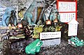
 Board of Island Park on Nokonoshima Island.JPG 3,182 × 2,387; 2.57 MB
-
 Cape Kanenomisaki and Mount Yukawayama from Konominato Port 2.JPG 3,264 × 2,448; 1.77 MB
-
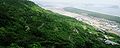
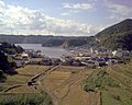 Fishing village Kariya Genkai Saga Japan up20060427.jpg 1,280 × 1,024; 952 KB
-
 Fukuoka NASA STS059-97-63AJ.jpg 784 × 787; 195 KB
-
 Genkai Sea from train of Chikuhi Line in Fukui, Nijo, Itoshima, Fukuoka 2.jpg 3,264 × 2,448; 2.24 MB
-
 Genkai Sea from train of Chikuhi Line in Fukui, Nijo, Itoshima, Fukuoka.jpg 3,264 × 2,448; 1.76 MB
-
 Genkai Sea, Tategami Rocks and Kashiwajima Island from Route204 in Yakataishi.jpg 4,608 × 3,456; 6.38 MB
-
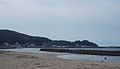 Hatsu Fishing harbor.jpg 2,592 × 1,500; 406 KB
-
 Ise.- le sanctuairede la plage de Futamigaura.jpg 4,089 × 2,686; 7.58 MB
-
 Ise.-Sanctuaire plage de Futamigaura.jpg 1,600 × 1,194; 1.43 MB
-
 Iwaya beach Kitakyushu.JPG 640 × 480; 65 KB
-
 Iwaya beach Wakamatsu.JPG 640 × 480; 64 KB
-
 Iwaya port.JPG 2,816 × 2,112; 1.81 MB
-
 Karatsu Bay from train of Chikuhi Line in Shikaka, Nijo, Itoshima, Fukuoka.jpg 3,171 × 2,378; 2.24 MB
-
 Konominato Beach and Mount Kodaijisan.JPG 3,264 × 2,448; 1.86 MB
-
 Oura rice terrace and Imari bay 2009-04.jpg 2,258 × 1,500; 604 KB
-
 Road to MtKagami.jpg 1,280 × 514; 313 KB
-
 Sanri-matsubara Beach.jpg 2,592 × 1,400; 378 KB
-
 Sea cliff and plants at Cape Kawarakezaki.jpg 4,608 × 3,456; 6.28 MB
-
 Sea Of Genkai up20060427.jpg 1,280 × 1,024; 1.01 MB
-

-
 Sunset view from Myōken Headland 6 Odo-2-chōme Nishi-ku Fukuoka City 20221027.jpg 4,000 × 2,000; 2.54 MB
-
 Tachibanayama01.jpg 1,280 × 605; 677 KB
-
 Tanada00.jpg 3,072 × 2,048; 2.18 MB
-
 View of Cape Kusazaki, Katsushima Island and Oshima Island from Ferry "Oshima".JPG 3,264 × 2,448; 2.4 MB
-
 View of Gate of Island Park on Nokonoshima Island.JPG 3,264 × 2,448; 2.48 MB
-
 View of Katsushima Island and Oshima Island from Ferry "Oshima".JPG 3,260 × 2,445; 2.38 MB
-
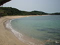
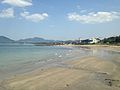
 View of Niginohama from Mount Hi, Itoshima - Aug 25, 2012.jpg 1,280 × 852; 245 KB
-
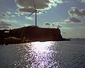 Wind turbine Genkai Saga Japan up20060427.jpg 1,280 × 1,024; 978 KB
.jpg)
.jpg)


